Unmanned Aerial Vehicle – UAV popularly known as drone, is an airborne system or an aircraft operated remotely by a human operator or autonomously by an onboard computer. There are two broad classes of UAVs – Fixed wing and Rotary based. UAV combined with remote sensing technology have been creating new vistas in global scenario to acquire the geospatial data on land resources and environment. The imagery obtained from UAVs can immensely support in many applications ranging from large-scale mapping, urban modelling to vegetation structure mapping. Specifically in the NE region of our country with limited connectivity and difficult terrain condition, the local planning and developmental activities can be greatly improved by the UAV survey.
UAV remote sensing (UAV-RS) is the new addition to the North Eastern Space Applications Centre (NESAC) for large-scale mapping and real time assessment, monitoring activities under various applications. NESAC has taken initiative for design and assembling of UAV for various applications. Different components of the UAV are selected based on the design parameters and assembled as per the requirements.
Facilities such as UAV data processing lab, digital photogrammetric systems, GIS systems, survey systems like GPS, etc., supported by dedicated human resources take care of all the analysis and processing requirements.
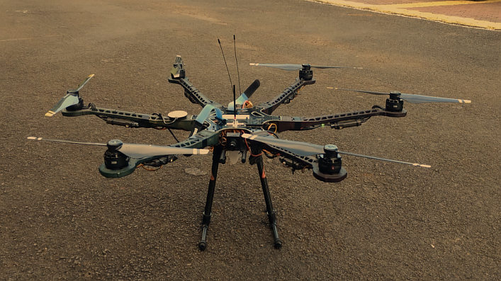
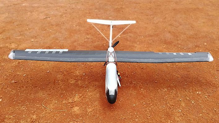
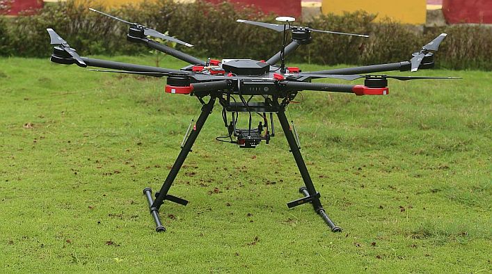
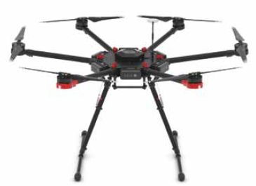
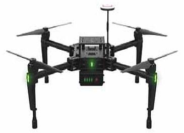
The Centre has both fixed wing UAV and multirotor based UAVs – quad copter and hexa-copter and has capability for both manual as well as autonomous flights. The fixed wing UAV has a flight endurance of about 50-60 mins with a flying range of 5-10 kms and heavy payload capacity. The copter type UAV has 1.5-2.0 kg of payload capability and can be customized to carry sensors such as Thermal, Multispectral, Optical, Hyper spectral or LIDAR etc. It can attain maximum altitude up to 500 m with range of 2 Kms. It can fly for about 20-40 mins.
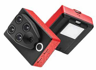
NESAC has RGB cameras ranging from 12 MP to 42 MP RGB camera with zooming capability. The cameras can capture videos up to 4K resolution and images at fixed intervals i.e. 2-10 secs. NESAC also has a dual Multispectral sensors which can give 10 spectral bands with the ability to capture images at 8cm per pixel when flying at altitude of 120 m. The hyperspectral camera can carry out data acquisition with 1000 spectral bands. All the sensors provided geotagged images in Jpeg/Tiff format.
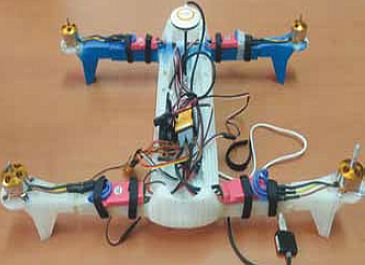
3D printing facility is new edition to UAV Lab at NESAC. The printer is having a build volume of 215 X 215 X 300 mm with a max. resolution of 20 microns and supports different materials such as PLA, Nylon, ABS, PVA etc. for printing. The 3D printer is being used to develop inhouse mini UAVs along with other accessories related to UAVs. A mini quad copter has been designed and printed using 3D printer with Nylon material having a dimension of 100 X 300 X 70 mm and total weight of 1kg.
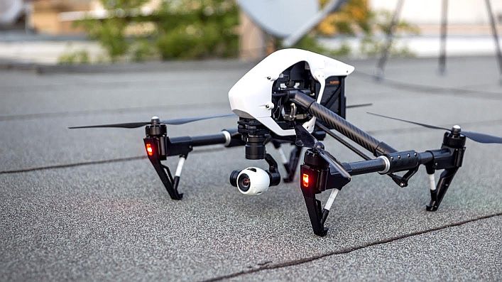
NESAC has facilitated all the State Remote Sensing Centers (SRSACs) of North Eastern Region (NER) in setting up of UAV Remote Sensing facility which is funded by North Eastern Council (NEC). Each of the SRSACs were provided with a quad copter (M100) and a UAV data processing software (AGISoft). NESAC has also provided training on UAV operation, data acquisition & processing and also providing continuous support to all the SRSACs.
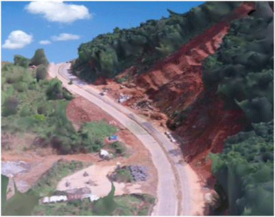
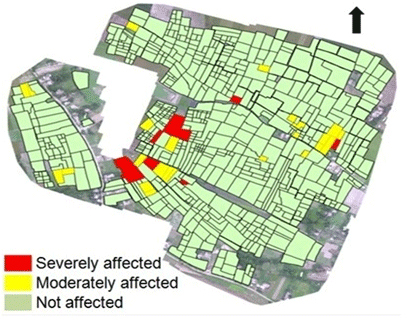
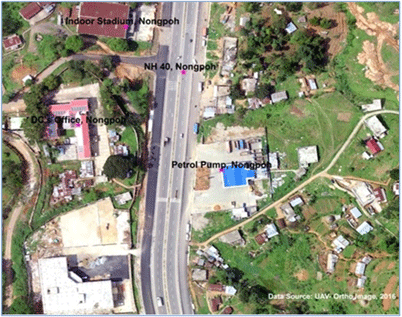
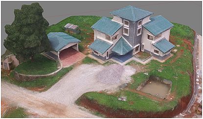
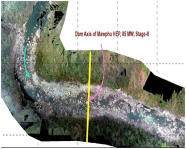
The imagery obtained from UAVs can immensely support in many applications ranging from large-scale mapping, disaster assessment, infrastructure planning, urban modeling to vegetation structure mapping. Specifically in the NE region of our country with limited connectivity and difficult terrain condition, the local planning and developmental activities can be greatly improved by the UAV survey. NESAC has conducted numerous UAV surveys until the date to assist different line departments and research work in NER. NESAC has also facilitated all the State Remote Sensing Centres of NER in establishing UAV facility. NESAC also conducts on demand surveys for different central/state/private departments to support their planning activities at a very nominal cost.