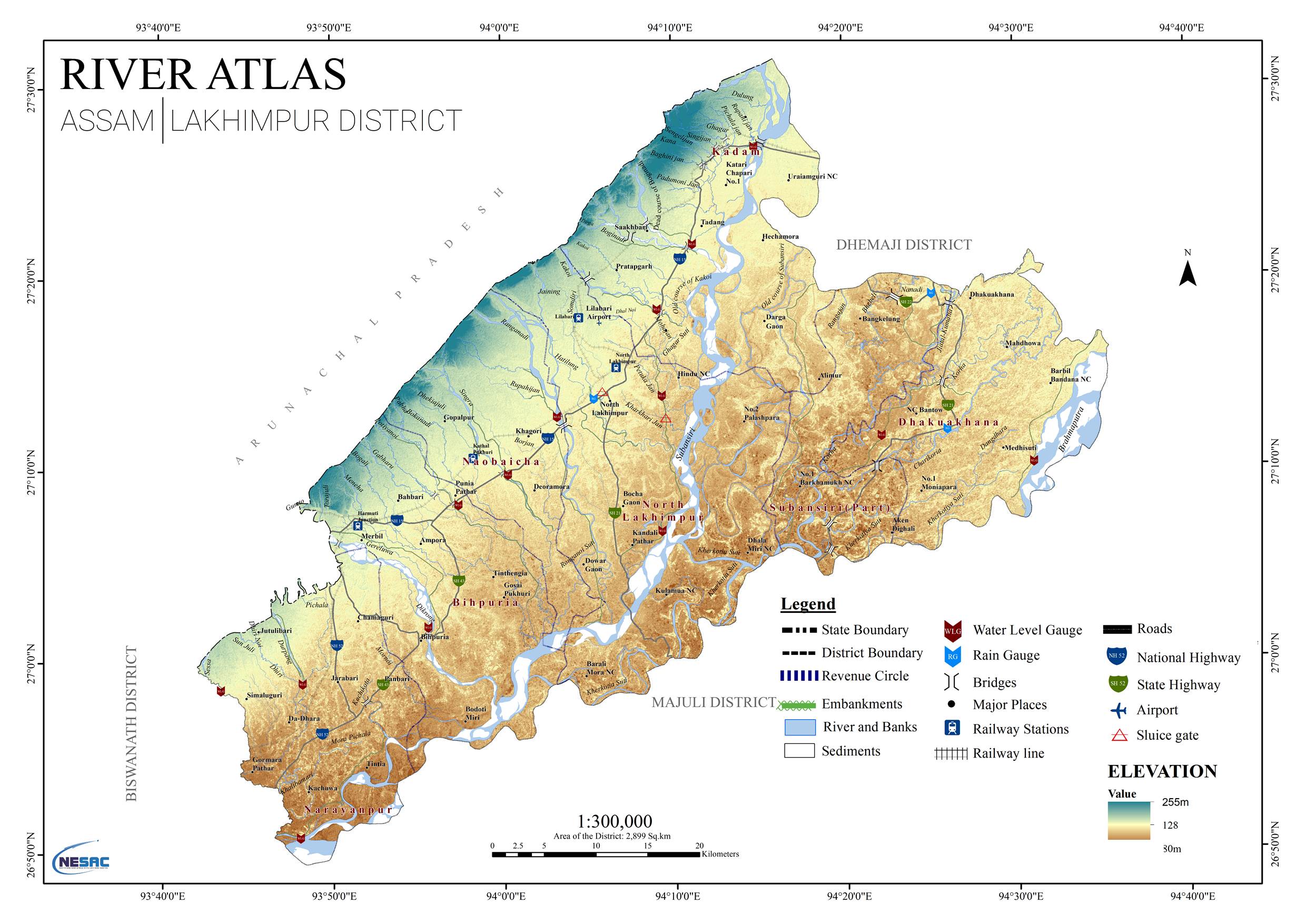
The river atlas preparation for Assam has been initiated during 2017. In this project, all the major and minor rivers entering Assam has been mapped at a scale of 1:4,000. Mapping includes incorporation of left and right bank, sediments, embankments, hydro-meteorological observatories, sluice gates, P&RD bunds, major locations, roads, railway lines etc. The LULC map for all the rivers has been created with defined buffer. In addition to this, district wise river catchment maps are being prepared to show the origin of all the rivers entering the respective districts of Assam. At present the project is in progress and mapping is in completion stage for 20 districts of Assam. In an interim review of this project during January, 2018, Hon’ble Chief Minister, Assam, expressed satisfaction on progress of the project and hoped that this exercise will be of great help in river planning & development in Assam. There is no river atlas for Assam mapped at a scale of 1:5000. Hence, this activity has been taken up.The outputs will be benefited by Water Resource Dept. and Disaster Management Authorities.The outputs will be used for proper monitoring and management of river system features in the state. For more details about the project, North Eastern Space Applications Centre (NESAC) can be contacted.
Water Resources
The project envisages monitoring and evaluation of IWMP projects using Bhuvan web services and Mobile app for the sanctioned projects from 2009-10 to 2014- 15 (This may differ State to State) for entire India and NESAC is carrying out the project for North Eastern part of India. Each project has to be monitored for a period of 5 years from the date of implementation. The project is being implemented at NRSC and geo spatial tools have been developed (Srishti – a web GIS interface on Bhuvan and Drishti – a mobile based android application). The project duration is up to 2020. The scope of the work of this project include Processing of high resolution satellite data – LISS-IV and Cartosat; Correction / fine tuning of Watershed boundaries based on SIS-DP database; Generation of LULC maps, NDVI, evaluation and assessment based on Drishti photographs , preparation of maps showing change detection in projects supported by limited ground truth of representative sites. The approach includes report generation for each project area year wise in suggested format. NESAC is carrying out following activities in collaboration with State Remote Sensing Application Centers of NER:
- Processing of high resolution satellite data- LISS IV and Cartosat.
- Correction/ fine tuning of watershed boundaries based on SIS-DP Satellite Image.
- Generation of LULC maps, NDVI, evaluation and assessment based on Dristi photographs, change detections maps coupled with ground truth as well as year wise report generation for each project area.
- All the processed data will be made available for online analysis/interpretation.
This study enables multi-cropping and the introduction of diverse agro based activities, which help to provide sustainable, livelihoods to the people..The outcome will benefit the society.It helps in regeneration of natural vegetation rain water harvesting and recharging of ground water table. For more details about the project, North Eastern Space Applications Centre (NESAC) can be contacted.
Watershed Development is the new unit of rural development. It includes planning for sustainable development of natural resources of the watershed. Department of Land Resources (DoLR) is doing development activities of watersheds through Integrated Watershed Management Programme (IWMP) and releasing fund to State Level Nodal Agencies since a decade back. Now DoLR wants monitor and evaluate the impact of IWMP. This project is initiated for this purpose at request of DoLR and NESAC is participated with NRSC. NESAC is coordinating this project for NE India. This project will help in monitoring the progress of the programme and evaluate its impact in ground.
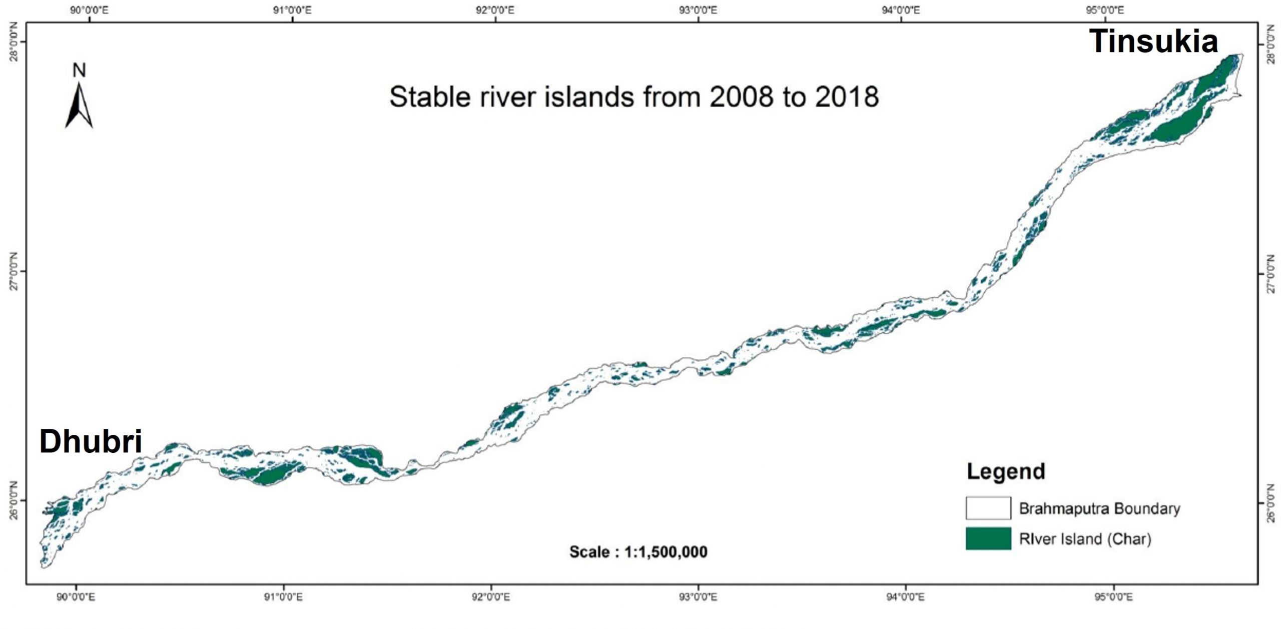
In this study the river configuration of the Brahmaputra main channel has been undertaken to map the changes and present status in order to assess the stability/instability of the chars using satellite remote sensing. This study includes assessment of total aggradation and degradation to the chars during the study period of past 30 years (i.e. from 1988 to 2018). Also, identification of settlement in the stable islands and connectivity to main land has been carried out. This study has been carried out for identification of stable islands in Brahmaputra river. The study will be benifited by state departments of Assam. The outputs will help in understanding the soil dynamics in Brahmaputra river. For more details about the project, North Eastern Space Applications Centre (NESAC) can be contacted.
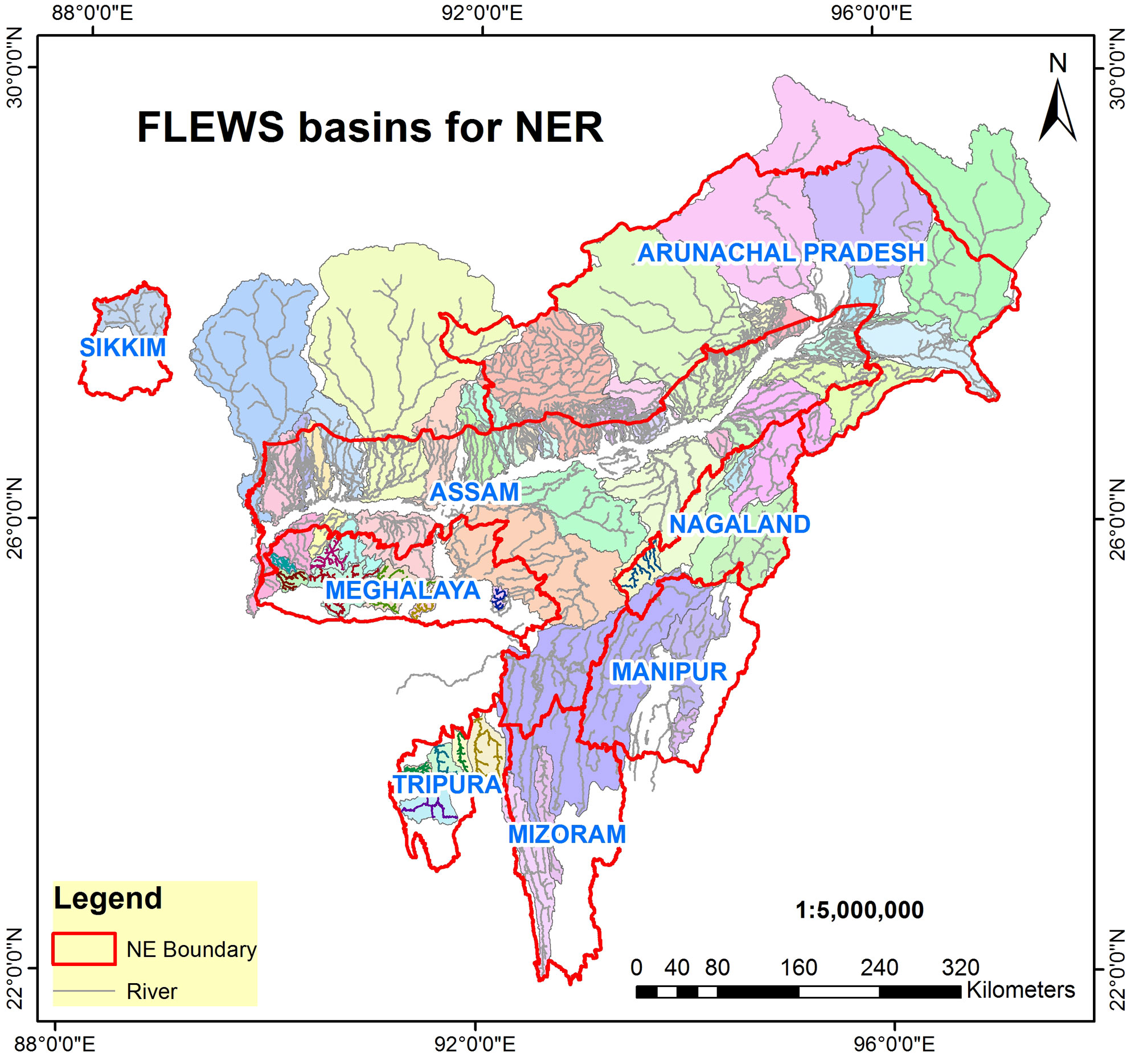
In India, the north eastern state of Assam is one of the most complex fluvial systems of rivers mainly with two inter-connected river valleys namely Brahmaputra and Barak which together enters the bay of Bengal. Due to enormous sediment transport from the upper catchment areas and subsequent lack of carrying capacity of the channels in these two river valleys, flooding is a periodic phenomenon every year during the peak monsoon months causing extensive damage to life and property. After a devastating flood event in Lakhimpur district of upper Assam in June, 2008, at the request of Government of Assam, NESAC took the responsibility of piloting an exercise with application of space based numerical rainfall prediction and a physics based distributed hydrological model in GIS platform.The technical component of this exercise comprises of two sub component namely the numerical rainfall prediction model called the WRF and a GIS based distributed hydrological model known as HEC-HMS. The model intake the predicted rainfall values and giving predicted values of peak discharge as well as hydrographs which in turn is compared with established flooding threshold discharge values of the river or tributaries concerned in order to generate the flood alerts and disseminated accordingly to the revenue circles and district concerned in terms of simple flood advisories. All these years since the beginning, an average year to year alert success score of 75% and an average alert to alert lead time of 24 to 48 hours have been maintained. FLEWS was declared as a Professional Best Practice by the Department of Administrative reforms under Union ministry of Public Grievances and Pensions in the year 2012. The same year FLEWS was also shortlisted as a finalist for Prime Minister’s award for innovations in Public Administration. FLEWS was also honoured as the Winner of E-North East award for E-Governance and citizen services delivery by the North East development foundation, New Delhi in the year 2013. Till date many parliament questions regarding feasibility of implementation of FLEWS in other flood prone states have been answered by ISRO. This activity has been taken up with the request from Govt. of Assam. The alerts issued under this project helps the disaster management authority for flood monitoring, mitigation and management well in advance before the occurrence of floods. For more details about the project, North Eastern Space Applications Centre (NESAC) can be contacted.
