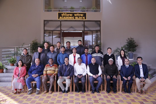
North Eastern Space Applications Centre (NESAC) conducted5 Day Training Course on “Geographical InformationSystem (GIS) in Disaster RiskManagement” for the officials sponsored by National Disaster Management Authority (NDMA), Govt. of India, at NESAC Outreach Campus, Umiam, Meghalayaduring 9-13thDec, 2019. Total 18 officials from both Central and State organizations like, DoT, SDMA, DDMA, IMDetc from Eastern and North Eastern parts of India participated in this training.
Total 18 theory classes were taken on diverse topics including Basics of Remote Sensing(RS), Geographical Information System (GIS), Global Navigation Satellite System (GNSS) and their applications to various disasters like flood, forest fire, landslide, earthquake, thunderstorm, cyclone, lighteningetc apart from weather forecasting, web-GIS, satellite communication and UAV technology. The course includes 4 invited lectures by resource persons from NRSC, GSI on the topics related to the course like Earthquake- seismic risk-Seismotectonic domains, Landslide Hazard zonation & early warning and National Database for Emergency Management (NDEM) in addition to 3 Practical sessions for hands on training on flood forecasting, landslide susceptibility mapping and GNSS.On full day field visit conducted to demonstrate Doppler Weather Radar (DWR), Unmanned Aerial Vehicle (UAV), Indian Navigation Satellite System (NaVIC) – Global Navigation Satellite System (GNSS) systems to the participants.


