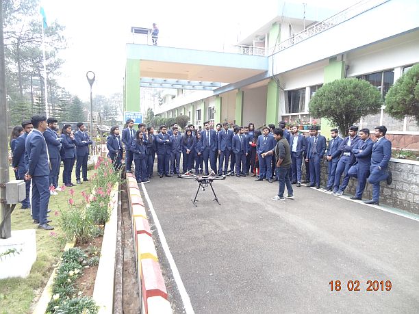
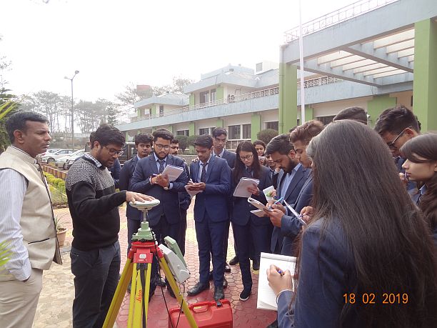
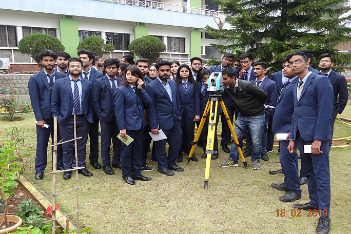
53 students of B.Tech (Geoinformatics Engineering) from University of Petroleum and Energy Studies (UPES), Dehradun visited NESAC during 18-19 February, 2019. The students were accompanied by three faculties of the university. . The students were familiarized with space technology and space applications through presentations and demonstrations. Director, NESAC welcomed the students and faculties and given a brief overview of recent trends in Geoinformatics technology at lecture hall in NESAC Outreach facility. The students asked several questions related to space technologies . The students were familiarized about different projects and other activities of NESAC through presentations by Dr. K.K. Sarma, Shri M Somorjit Singh and Dr. Gopal Sharma. A visit to various facilities of the Centre was also arranged for the students and operations of various high end equipments were demonstrated. This includes Differential Global Navigation Satellite System (dGNSS), Total Stations and Unmanned Aerial Vehicle (UAV). Various geo-portals and dashboard systems developed by NESAC were explained to the students. On second day (19th February, 2019), the students visited Doppler Weather Radar (DWR) facility located at Cherrapunjee, where the use and applications of DWR was explained to the students. The two days visit of the students was coordinated by Dr. Gopal Sharma, Scientist, NESAC