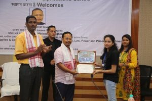
The three week Basic Course on Remote Sensing and GIS was organized at NESAC during June 03-21, 2019. 39 Participants from Govt. Departments, Academia and students were enrolled for the course. The programme saw the participation of the Soil and Water Conservation Dept of Shillong and Nongstoin, PHE Shillong, Irrigation Dept of Assam, NIC Kolhapur as well as several students, researchers and faculty members from the academia from across the country. The program was inaugurated on 3rd June 2019 by Director NESAC in presence of all the participants. The course covered all the aspects of remote sensing and GIS. It was segregated into 5 modules: the basic Remote Sensing Module, the GIS module, Navigation Module, Advanced Techniques Module and the Application Module. The Basic Remote Sensing, GIS and Navigation modules covered all the essential topics necessary for embarking upon a journey in remote sensing and GIS. The advanced techniques covered the topics pertaining to Microwave Remote Sensing, Hyperspectral Remote Sensing, UAV Remote Sensing, Web Based Serviced for Remote Sensing and GIS, Machine Learning and AI for Remote Sensing and Cloud Computing for Remote Sensing using Google Earth Engine. The application module entailed a set of classes followed by project work in the following application domains: (1) Forestry, Ecology and Biodiversity, (2) Land and Water Resources, (3) Space and Atmospheric Physics, (4) Disaster Risk Reduction, (5) IT and Geoinformatics, (6) Geosciences and (7) Urban Studies. A field visit and visit to facilities at NESAC and the Doppler Weather Radar at Cherrapunjee was also conducted.
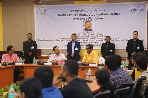
The valedictory function was held on 20th June 2019, where Shri James Sangma, Minister of District Council Affairs, Food, Civil Supplies & Consumers Affairs, Home (Passport & Police), Law, Power and Prisons Departments, Govt,of Meghalaya graced the occasion as the Chief Guest in presence of Director, NESAC and all the participants & faculty members.
