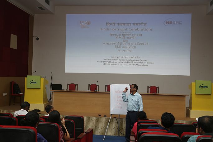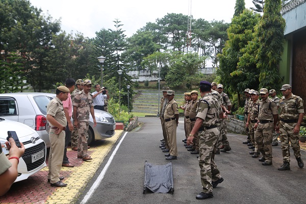
A joint Mock Drill was conducted at NESAC on 17th September 2019 on Earthquake Evacuation for the staff of NESAC. Personnel from NESAC CISF Unit, Ri Bhoi District Disaster Management Authority, Local Police from Umiam Police Station, Meghalaya Fire & Emergency Services personnel from Umiam Station, personnel of Meghalaya Home Guard stationed at NESAC, NESAC Safety Team & Administration along with staff of NESAC participated in the Mock Drill exercise. Smt. K. Wanniang, District Disaster Management Officer, Ri Bhoi District gave an informative lecture on the best practices during earthquake event and need for earthquake preparedness. Shri K Ramdas, Asst. Commandant, NESAC CISF Unit briefed the staff regarding their roles during the mock drill. After the briefing, staff were sent to their respective sitting places and sometime later, the mock drill was initiated by sounding a surprise siren symbolizing the earthquake event. On hearing the siren, staff of NESAC came out of the building and gathered at the pre-decided assembly point. Then personnel of CISF Unit, acting as the first responders, carried out a search and rescue operation in the office building to take out the people acting as injured. The Mock Drill was concluded with sharing of experience by the participants