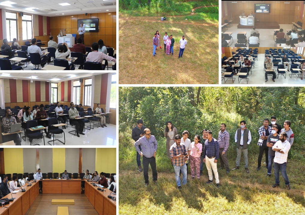
NESAC successfully conducted an one week training program on UAV technology and its applications in the field of Forestry during Nov 08- 12, 2021 for the Forest Department officials from the Government of Assam. The course covered all the aspects of understanding the UAVs and its components, flight planning for data acquisitions for various remote sensing applications with focus on forestry applications, 3D printing & its application in UAV along with different data processing techniques. The data processing includes generation of Orthomosaic, digital surface model (DEM), digital terrain model (DTM), contour maps, volumetric analysis etc using Pix4D Mapper Pro ArcGIS and QGIS softwares. The participants were also given hands-on experience of total end to end work flow starting from UAV operations, mission planning, data processing and data analysis.
North Eastern Space Applications Centre
Government of India, Department of SpaceUmiam, Meghalaya